Extent of the damage
 In a memo (1) dated July 14, 1944, written by H. A. Steward, Esq. of Parliament Street and addressed to F. L. Robertson, Esq., secretary of the Cadogan Settled Estates Company of Sloane Street, the magnitude of the destruction to Sloane Court East was assessed. The Cadogan Settled Estates Company owned and still owns the Sloane Court East properties. The memo, “Cadogan Settled Estates Company, War Damage, Sloane Court East,” makes the following observations:
“Nos. 6, 8 & 10 are almost entirely destroyed.
“Nos. 12 to 20 have all suffered very severe damage and some will require rebuilding.
“No. 1 – a block of flats has been almost entirely destroyed.
“No. 3 – a block of flats has been very severely damaged.
“All the above must be considered to be unfit, and if you receive notices under the Landlord and Tenant Act 1939 they must be accepted.
“No. 5 – a block of flats has had considerable damage, though it may be the whole building is not unfit. If you should receive notice it would be well to inspect this block
before accepting the notice.”
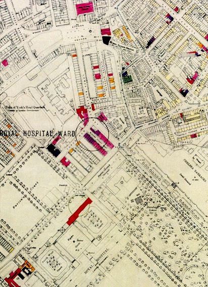
The bomb damage map at right, reprinted with permission of the City of London, London Metropolitan Archives, depicts the site of the bombing (click the map to enlarge). The large circle around Sloane Court indicates the site of a bombing, and the purple color indicates heavy damage. The lighter colors indicate the area of the street where less damage occurred.
Diagrams
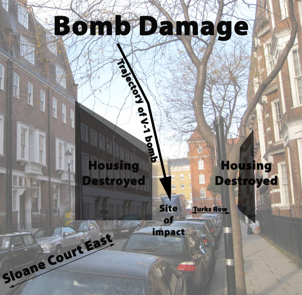
The V-1 bomb that hit Sloane Court destroyed many of the buildings on the street, including those housing soldiers. Below, a modern view of Sloane Court East shows where the damage occurred. The right-hand side is the north side of the street, and the left-hand side is the south side of the street.
Seen from the same direction with Turks Row in the background and Sloane Court East in the foreground, the magnitude of the destruction can be seen below.
A change in architecture
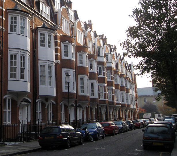
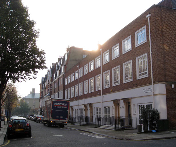
After the buildings were destroyed, they were replaced with more modern buildings. Compare the architecture seen below. In the first picture, taken from Sloane Court West, the original architecture of the buildings can be seen. Compare this picture with the second one, taken of a section of Sloane Court East destroyed in the bombing.
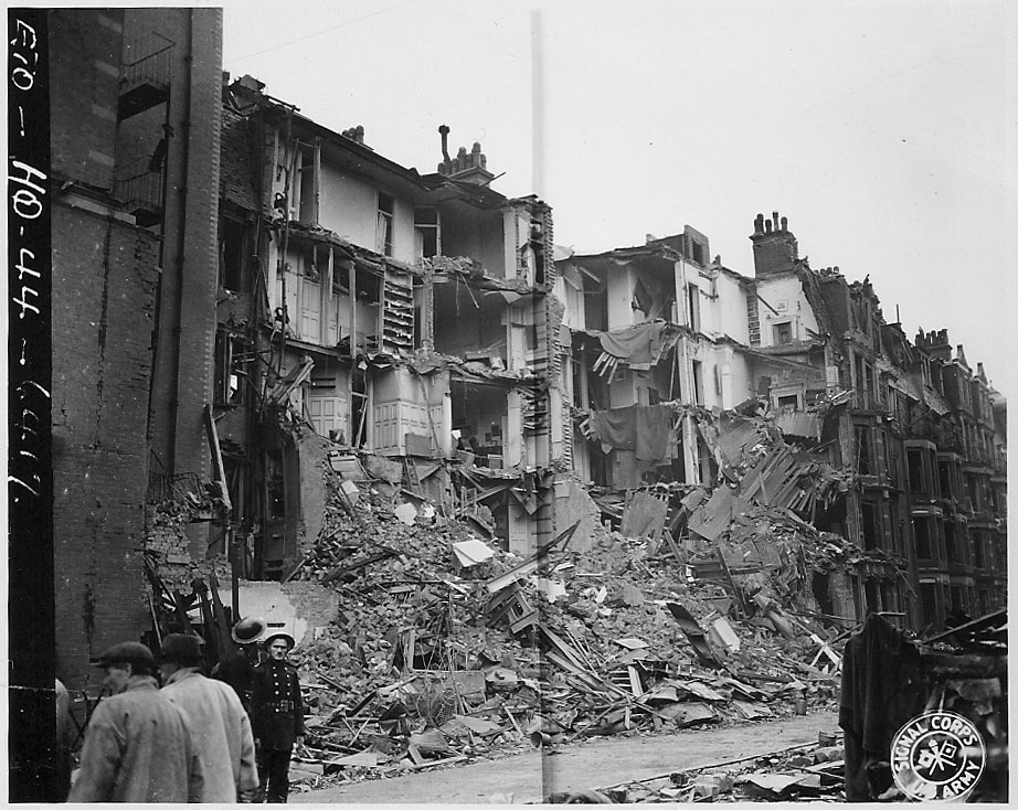
The photo below is believed to be the same view of Sloane Court East after the July 3, 1944, bombing.
Another view of the south side of the street shows a similar change in architecture.
Although seen from a different angle, the below photo from July 3, 1944, which shows number 6 Sloane Court where the 130th Processing Company was stationed, conveys the magnitude of the damage done to the original building.
The differences in architecture between the portion of Sloane Court East that was bombed and the rest of the street is apparent today.
Sources
(1) Memo, H. A. Steward to F. L. Robertson, “Cadogan Settled Estates Company, War Damage, Sloane Court East,” 14 July 1944, in war damage archives of the Cadogan Estate.

